
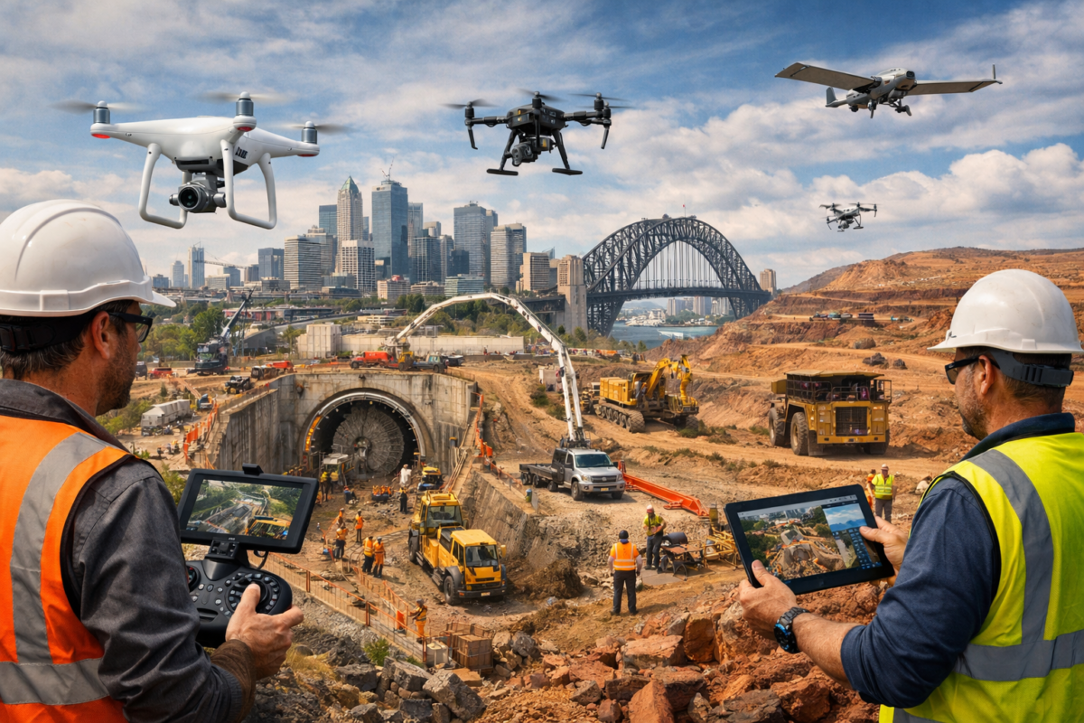
The Australian construction industry faces unique challenges that set it apart from construction sectors in other developed nations. With major infrastructure projects spanning vast distances—from the Sydney Metro expansion to remote mining operations in the Pilbara—construction companies must manage sites that can cover hundreds of hectares, employ thousands of workers, and operate in environments ranging from dense urban centres to isolated outback locations. Add to this Australia’s stringent workplace health and safety regulations, tight project timelines, and the constant pressure to deliver projects on budget, and it becomes clear why construction companies are increasingly turning to drone technology as a critical management tool.
Construction sites are inherently dynamic environments where conditions change daily, risks evolve constantly, and the cost of errors can run into millions of dollars. Traditional site management methods—walking the site, manual measurements, periodic photography, and paper-based inspections—struggle to keep pace with the complexity and scale of modern construction projects. A site manager on a large infrastructure project might spend hours each day simply traversing the site to observe progress and identify issues, time that could be better spent on analysis and decision-making.
Drones are transforming this paradigm by providing construction managers with unprecedented visibility, data accuracy, and operational efficiency. A drone can survey a 50-hectare construction site in 20 minutes, capturing thousands of high-resolution images that reveal details invisible from ground level, identify safety hazards before they cause incidents, and provide objective documentation of progress that eliminates disputes and accelerates decision-making.
The economic impact is substantial. Research indicates that drone technology could deliver cost savings of $1.8 to $4.3 billion to the Australian construction industry between 2020 and 2040 through improved efficiency, reduced rework, enhanced safety, and better project management. These aren’t theoretical benefits—construction companies across Australia are reporting measurable improvements in project outcomes, with some major contractors now considering drone surveys as essential as traditional surveying or engineering services.
This article explores how drones are improving construction site management and safety across Australia, from high-rise developments in Melbourne to road construction in regional Queensland, from mining infrastructure in Western Australia to renewable energy projects in South Australia. We’ll examine the specific applications delivering results today and provide practical guidance for construction companies considering drone adoption.
The Construction Safety Imperative
Before exploring specific drone applications, it’s important to understand the safety context that makes drones particularly valuable in construction.
Construction consistently ranks among Australia’s most dangerous industries. Safe Work Australia data shows that construction accounts for approximately 10% of all workplace fatalities despite representing only 9% of the workforce. Falls from height, being struck by moving objects, and incidents involving mobile plant and equipment are the leading causes of construction fatalities.
Beyond the human tragedy of workplace injuries and deaths, safety incidents carry enormous financial costs:
- Direct costs: Medical expenses, workers’ compensation claims, legal fees, and potential fines from regulators
- Indirect costs: Project delays, productivity losses, increased insurance premiums, reputational damage, and difficulty attracting skilled workers
- Regulatory consequences: Work stop orders, prosecution by workplace safety regulators, and increased scrutiny on future projects
A serious safety incident on a major project can cost millions in direct expenses and project delays, not to mention the reputational damage that affects future tender opportunities.
Drones address safety in two fundamental ways:
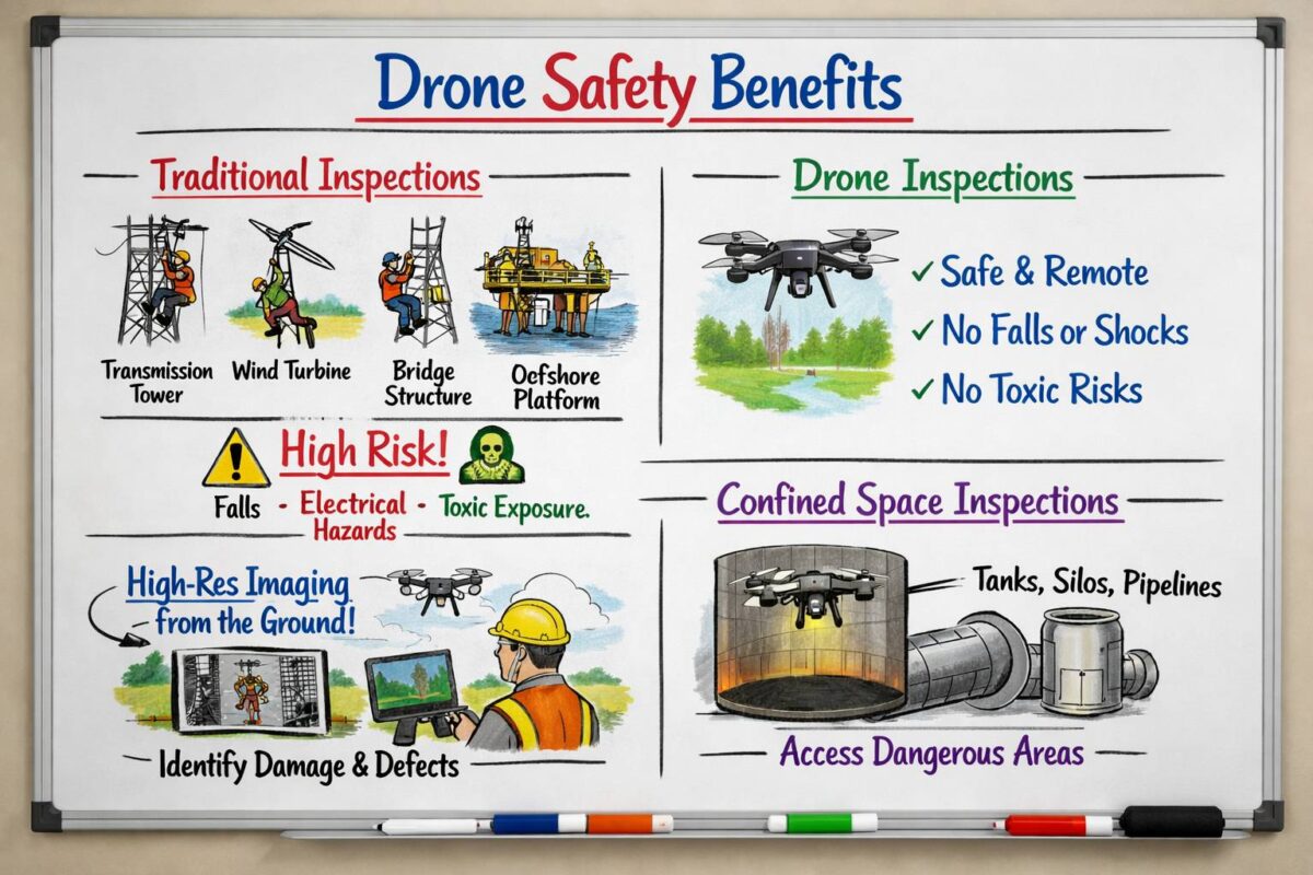
- Removing people from hazardous situations: Inspections that previously required workers to access dangerous locations (roofs, heights, confined spaces, unstable structures) can now be conducted remotely with drones.
- Identifying hazards before incidents occur: Regular drone surveys reveal safety hazards—unsecured materials, structural issues, access problems, environmental risks—allowing intervention before workers are exposed.
This safety value alone justifies drone investment for many construction companies, but the operational benefits extend far beyond safety.
1. Real-Time Site Monitoring and Progress Tracking
The ability to capture comprehensive, up-to-date information about site conditions and construction progress is perhaps the most widely adopted drone application in Australian construction.
Comprehensive Site Documentation
Traditional progress documentation relies on ground-level photography, manual observations, and periodic professional surveys. This approach has significant limitations:
- Incomplete coverage: Ground-level photos can’t capture overall site layout or progress in inaccessible areas
- Time-consuming: Walking large sites to photograph all areas takes hours
- Subjective: Different people photograph different things, making consistent documentation difficult
- Limited perspective: Ground-level views don’t reveal spatial relationships or overall progress
Drones overcome these limitations by capturing complete site coverage from aerial perspectives in a fraction of the time. A 20-minute drone flight can document an entire construction site with hundreds of high-resolution images, providing:
- Consistent coverage: Every area of the site captured from the same altitude and angles each flight
- Objective documentation: Comprehensive imagery that shows actual conditions without subjective selection
- Aerial perspective: Overview shots that reveal spatial relationships, logistics flow, and overall progress
- Detailed close-ups: High-resolution cameras capture fine details when needed
Progress Tracking and Reporting
Regular drone surveys—typically weekly or fortnightly—create a visual timeline of construction progress that serves multiple purposes:
Client reporting: Construction companies use drone imagery to provide clients with compelling visual updates. Rather than written reports describing progress, clients receive aerial photos and videos showing exactly what’s been accomplished. This transparency builds trust and reduces client queries.
The Sydney Metro project, one of Australia’s largest infrastructure undertakings, has extensively used drone technology for progress documentation. Weekly drone surveys across multiple construction sites provide project managers and stakeholders with consistent visual records of progress, helping coordinate the complex logistics of simultaneous construction activities across the metro network.
Internal coordination: On large projects with multiple contractors and subcontractors, drone imagery provides a common reference point. Trade coordinators can review aerial images to plan sequencing, identify conflicts, and coordinate access. This shared visual understanding reduces miscommunication and improves workflow efficiency.
Schedule verification: Comparing actual progress (shown in drone imagery) against planned schedules helps project managers identify delays early. If earthworks are behind schedule or structural steel erection is progressing slower than planned, drone imagery provides objective evidence that triggers corrective action before delays compound.
Dispute resolution: Construction disputes often centre on questions of timing and responsibility—when was work completed, what were site conditions at a specific time, who was responsible for particular issues? Comprehensive drone documentation provides objective evidence that resolves disputes quickly. Several Australian construction companies report that drone documentation has saved hundreds of thousands of dollars in dispute resolution costs by providing irrefutable evidence of site conditions and progress.
Integration with Project Management Software
Modern construction management platforms like Procore, Autodesk Construction Cloud, and PlanGrid can integrate drone imagery directly into project workflows:
- Automated progress tracking: AI-powered software compares drone imagery against BIM (Building Information Modelling) models to automatically calculate completion percentages for different project elements
- Issue tracking: Site managers can annotate drone images to flag issues, assign responsibility, and track resolution
- Schedule integration: Link drone imagery to project schedules, providing visual verification of milestone completion
- Document management: Store drone imagery alongside other project documentation for comprehensive project records
This integration transforms drone data from interesting images into actionable project management information.
2. Safety Inspections and Hazard Identification
Drones are revolutionising construction safety by enabling comprehensive hazard identification without exposing workers to risk.
Pre-Work Safety Inspections
Before workers access potentially hazardous areas, drones can conduct preliminary inspections to identify risks:
Roof inspections: Rather than sending workers onto potentially unstable roofs, drones can inspect roof conditions, identify structural issues, and assess safe access points before any worker climbs up.
Scaffolding inspections: Drones can inspect scaffolding installations from all angles, identifying missing guardrails, unstable connections, or overloaded platforms without requiring inspectors to climb the scaffolding.
Excavation safety: Deep excavations pose risks of collapse, flooding, or hazardous atmospheres. Drones can inspect excavation walls for instability, check shoring installations, and identify water ingress without workers entering the excavation.
Structural stability: On demolition projects or renovations of existing structures, drones can assess structural condition and identify hazards like loose materials, unstable walls, or deteriorated structural elements before workers enter.
Ongoing Hazard Monitoring
Regular drone surveys identify emerging hazards across the entire site:
Housekeeping issues: Aerial views reveal accumulations of materials, blocked access routes, or disorganised work areas that create trip hazards or impede emergency access.
Environmental hazards: Drones equipped with thermal cameras can identify water pooling, drainage issues, or heat sources that might indicate fire risks.
Edge protection: Aerial inspections quickly identify missing or damaged edge protection on elevated work areas—a leading cause of falls from height.
Material storage: Overhead views show whether materials are properly stored, secured against wind, and positioned to avoid creating hazards for workers or equipment.
A major mining construction project in the Pilbara region of Western Australia implemented weekly drone safety inspections across their 200-hectare site. In the first six months, drone inspections identified 47 safety hazards that were corrected before any incidents occurred, including unsecured materials that could have been blown by strong winds, damaged edge protection on elevated platforms, and unstable stockpiles that posed collapse risks.
Incident Investigation
When safety incidents do occur, drones provide valuable investigation capabilities:
- Scene documentation: Capture comprehensive imagery of incident scenes without disturbing evidence
- Perspective analysis: Aerial views help investigators understand sight lines, access routes, and spatial relationships relevant to the incident
- Historical comparison: Compare incident scene imagery against previous drone surveys to understand how conditions changed over time
This documentation supports thorough investigations and helps prevent similar incidents in the future.
3. Accurate Measurements and Volume Calculations
Construction projects require constant measurement—earthwork volumes, stockpile quantities, concrete pours, material deliveries, and progress measurements. Drones equipped with photogrammetry software provide measurement accuracy that rivals traditional surveying at a fraction of the cost and time.
Earthwork and Cut-Fill Analysis
Earthmoving represents a major cost component on many construction projects. Accurate measurement of earthwork volumes is essential for:
- Payment verification: Confirming quantities for payment to earthmoving contractors
- Material balance: Ensuring sufficient cut material is available for fill requirements
- Progress tracking: Measuring earthwork progress against schedules
- Dispute avoidance: Providing objective evidence of quantities moved
Traditional surveying methods require surveyors to establish grid points across the site and measure elevations at each point—a time-consuming process that might take days on large sites and provides only limited data points.
Drones capture thousands of elevation points across the entire site in a single flight, creating detailed digital terrain models that show exact ground elevations everywhere. Photogrammetry software then calculates cut and fill volumes by comparing current terrain against design models or previous surveys.
A road construction project in regional Queensland used weekly drone surveys to measure earthwork progress across a 15-kilometre alignment. The drone surveys, which took 2 hours to fly and process, replaced traditional surveying that would have required 3-4 days of surveyor time. The construction company reported that drone measurements were accurate to within 1-2% of traditional surveying whilst reducing measurement costs by 75%.
Stockpile Volume Measurement
Construction sites maintain stockpiles of various materials—aggregates, soil, sand, recycled materials. Accurate stockpile measurement is important for:
- Inventory management: Knowing how much material is on hand
- Ordering decisions: Determining when to order additional materials
- Payment verification: Confirming delivered quantities match invoices
- Waste tracking: Measuring waste materials for disposal planning
Drones can measure stockpile volumes in minutes with accuracy of 1-3%, compared to traditional methods (manual measurement or surveying) that are time-consuming and often inaccurate.
Concrete Volume Verification
For concrete pours, drones can measure the area and depth of pours to verify volumes, ensuring that delivered concrete quantities match what was actually placed. This helps identify discrepancies that might indicate waste, theft, or measurement errors.
As-Built Documentation
At project completion, drones create comprehensive as-built documentation showing final site conditions, elevations, and features. This documentation is valuable for:
- Handover to clients: Providing accurate records of completed work
- Future maintenance: Establishing baseline conditions for maintenance planning
- Warranty claims: Documenting construction quality and conditions
- Future projects: Creating accurate site models for future expansion or modification
4. Progress Documentation and Photo Evidence
Beyond general site monitoring, drones provide specific documentation capabilities that protect construction companies and improve project outcomes.
Time-Stamped Visual Records
Every drone flight creates a time-stamped visual record of site conditions. This documentation serves multiple purposes:
Proof of conditions: If disputes arise about site conditions at specific times, drone imagery provides objective evidence. Was the site accessible on a particular date? Were materials delivered when claimed? Was work completed before weather events? Drone records answer these questions definitively.
Weather event documentation: After storms, floods, or other weather events, drone surveys document damage and site conditions for insurance claims and schedule impact analysis.
Defect documentation: If defects are discovered, drone imagery can show when the defective work was performed and what conditions existed at the time, helping establish responsibility.
Regulatory compliance: Some regulatory approvals require periodic documentation of site conditions, environmental controls, or construction progress. Drone imagery provides this documentation efficiently.
Marketing and Public Relations
High-quality aerial photography and video from construction sites serves marketing purposes:
- Project showcases: Impressive aerial footage for company websites, proposals, and marketing materials
- Client presentations: Compelling visuals for client updates and presentations
- Recruitment: Showcasing major projects to attract skilled workers
- Public engagement: For projects affecting communities, aerial footage helps communicate progress and address concerns
The WestConnex motorway project in Sydney has used drone footage extensively for public communication, helping residents understand construction progress and see how the completed project will integrate into the urban landscape.
5. Environmental Compliance Monitoring
Construction projects in Australia face stringent environmental regulations covering erosion control, water quality, vegetation protection, and heritage site preservation. Drones help construction companies maintain compliance and demonstrate environmental responsibility.
Erosion and Sediment Control
Construction activities disturb soil and create erosion risks. Environmental regulations require erosion and sediment control measures like silt fences, sediment basins, and stabilised access points. Drones can:
- Inspect control measures: Verify that erosion controls are properly installed and maintained
- Identify failures: Detect damaged or ineffective controls before they cause environmental harm
- Monitor water quality: Thermal imaging can identify sediment-laden water leaving sites
- Document compliance: Provide evidence of environmental controls for regulatory inspections
Vegetation Protection
Many construction sites include protected vegetation that must be preserved. Drones equipped with multispectral cameras can:
- Monitor vegetation health: Detect stress in protected trees or vegetation
- Verify protection zones: Confirm that exclusion zones around protected vegetation are maintained
- Identify encroachment: Detect if construction activities are impacting protected areas
- Track rehabilitation: Monitor revegetation efforts in disturbed areas
Water Management
Drones help monitor water management on construction sites:
- Drainage inspection: Verify that site drainage is functioning properly
- Flooding assessment: Identify areas prone to water accumulation
- Water quality monitoring: Detect potential pollution sources
- Compliance documentation: Provide evidence of water management measures
A large infrastructure project in Melbourne used weekly drone surveys to monitor environmental controls across their site. The drone inspections identified several instances where erosion controls had been damaged by equipment or weather, allowing repairs before any environmental harm occurred. The project maintained perfect environmental compliance throughout construction, avoiding the fines and work stoppages that environmental breaches can trigger.
6. Reduced Rework Through Improved Planning
Rework—having to redo work that was done incorrectly the first time—is one of the most significant cost drivers in construction, typically accounting for 5-15% of total project costs. Drones help reduce rework by improving planning and identifying issues early.
Clash Detection and Coordination
On complex projects with multiple trades working simultaneously, coordination issues can lead to clashes where one trade’s work conflicts with another’s. Drones help identify these issues:
- Spatial verification: Aerial views show whether installed work matches design intent and coordinates with other elements
- Access planning: Identify access conflicts before they cause delays
- Sequencing verification: Confirm that work is proceeding in the correct sequence
Quality Verification
Regular drone surveys help identify quality issues early, when they’re easier and cheaper to correct:
- Alignment verification: Check that structures, roads, or utilities are aligned correctly
- Level verification: Identify areas where levels don’t match design requirements
- Installation verification: Confirm that materials and systems are installed according to specifications
Design Verification
Comparing drone-captured site conditions against design models helps identify discrepancies:
- Site condition verification: Confirm that actual site conditions match design assumptions
- As-built comparison: Identify where constructed work deviates from design
- Constructability review: Identify design issues that will cause construction problems
A commercial building project in Brisbane used weekly drone surveys compared against BIM models to verify construction accuracy. The drone surveys identified several instances where structural elements were slightly out of position—deviations of 50-100mm that would have caused significant problems for subsequent trades. Because the issues were identified immediately, corrections cost approximately $15,000. If the issues had gone undetected until later trades encountered problems, rework costs would have exceeded $200,000.
7. Better Decision-Making Through Aerial Perspective
The aerial perspective that drones provide fundamentally improves decision-making by revealing information that’s invisible from ground level.
Logistics and Site Layout Optimisation
Aerial views show how materials, equipment, and workers move around the site, revealing inefficiencies:
- Traffic flow: Identify bottlenecks in vehicle and equipment movement
- Material placement: Optimise material storage locations to minimise double-handling
- Laydown areas: Verify that laydown areas are being used efficiently
- Access routes: Identify opportunities to improve site access
Resource Allocation
Aerial imagery helps managers allocate resources effectively:
- Crew deployment: See where crews are working and identify areas needing additional resources
- Equipment utilisation: Verify that equipment is positioned where it’s needed
- Material distribution: Ensure materials are distributed to work areas efficiently
Strategic Planning
The comprehensive site understanding that drones provide supports strategic planning:
- Sequencing decisions: Plan work sequences based on complete site understanding
- Risk assessment: Identify risks and plan mitigation strategies
- Opportunity identification: Spot opportunities for efficiency improvements
CASA Compliance for Construction Drone Operations
Construction companies using drones must comply with CASA regulations, with some construction-specific considerations:
Operating Near Workers
Construction sites have workers present, which affects drone operations:
- 30-metre rule: Standard rules require maintaining 30 metres from people not involved in the operation
- ReOC requirements: Most construction site operations require a ReOC because maintaining 30 metres from all workers is often impractical
- Safety procedures: ReOC holders must have procedures for operating near workers, including briefings, designated flight times, and safety measures
Airspace Considerations
Many construction sites are located in controlled airspace or near airports:
- Urban projects: City construction sites are often in controlled airspace requiring ATC approval
- Airport proximity: Sites near airports require coordination with air traffic control
- Temporary restrictions: Major events or emergencies can create temporary airspace restrictions
Site-Specific Approvals
Some construction sites require additional approvals:
- Client requirements: Clients may require specific safety procedures or approvals
- Head contractor coordination: Subcontractors using drones must coordinate with head contractors
- Security clearances: Some sites (defence, critical infrastructure) require security clearances for drone operators
Most construction companies either employ drone operators with appropriate CASA credentials or engage specialist drone service providers who handle all regulatory compliance.
Cost-Benefit Analysis for Construction Companies
Understanding the financial case for drone adoption helps construction companies make informed decisions.
Investment Costs
Equipment: Professional-grade drones suitable for construction applications cost $5,000-25,000 depending on capabilities. Most construction companies start with mid-range equipment ($8,000-15,000).
Training and licensing: RePL training costs $2,000-4,500 per pilot. ReOC applications cost $5,000-15,000 including documentation development and CASA fees.
Software: Photogrammetry and analysis software costs $1,200-6,000 annually depending on features and usage.
Insurance: Drone operation insurance costs $1,500-5,000 annually.
Total first-year investment: $15,000-50,000 depending on approach (in-house vs. contracted services, equipment choices, number of pilots).
Operational Savings
Surveying costs: Drone surveys cost 50-75% less than traditional surveying for many applications. A construction company conducting weekly surveys might save $50,000-150,000 annually.
Safety improvements: Reducing safety incidents saves direct costs (medical, compensation, legal) and indirect costs (delays, productivity losses). Even preventing a single serious incident can save hundreds of thousands of dollars.
Rework reduction: Identifying issues early reduces rework costs. If drones help avoid just 1-2% of rework on a $50 million project, that’s $500,000-1,000,000 in savings.
Time savings: Faster site documentation and progress tracking saves project management time. On large projects, this can amount to hundreds of hours annually.
Dispute avoidance: Comprehensive documentation reduces disputes and associated costs. Several construction companies report six-figure savings from avoided disputes.
ROI Timeline
Most construction companies report ROI within 6-18 months:
- Large projects ($50M+): Often achieve ROI within 3-6 months through surveying savings and rework reduction
- Medium projects ($10-50M): Typically 6-12 months ROI
- Smaller contractors: 12-18 months, though many start with contracted services rather than equipment ownership
A mid-sized construction company in Adelaide invested $25,000 in drone equipment and training. In the first year, they saved $45,000 in surveying costs, avoided an estimated $80,000 in rework through early issue identification, and prevented a safety incident that would have cost approximately $150,000 in direct and indirect costs. Their first-year return was over 1000%.
The Transformation of Construction Management
Drones are fundamentally changing how construction projects are managed in Australia. The transformation goes beyond specific applications to affect construction culture and practices:
Data-driven decision-making: Construction management is shifting from experience-based decisions to data-driven analysis. Drones provide the comprehensive, objective data that enables this shift.
Proactive rather than reactive management: Regular drone surveys enable managers to identify and address issues before they become problems, shifting from reactive problem-solving to proactive management.
Transparency and accountability: Comprehensive documentation creates transparency that improves accountability across all project participants.
Safety culture: The ability to identify and address hazards before incidents occur strengthens safety culture and demonstrates commitment to worker wellbeing.
Client relationships: Better communication through visual documentation strengthens client relationships and builds trust.
Competitive advantage: Construction companies with strong drone capabilities can deliver projects more efficiently, safely, and profitably, creating competitive advantages in tender processes.
As drone technology continues to evolve—with improvements in automation, AI-powered analysis, and integration with other construction technologies—the benefits will only increase. For Australian construction companies, the question is no longer whether to adopt drone technology, but how quickly they can implement it to remain competitive in an increasingly technology-driven industry.
The construction companies achieving the best results are those that view drones not as a novelty or optional extra, but as an essential tool integrated into standard project management practices. They fly regularly (weekly or fortnightly), integrate drone data into project management systems, train multiple staff in drone operations, and continuously refine their procedures based on experience.
The $1.8-4.3 billion in potential savings for the Australian construction industry isn’t a theoretical projection—it’s the cumulative result of thousands of individual projects where drones help deliver better outcomes. For construction companies willing to embrace this technology, the benefits are real, measurable, and available today.
Frequently Asked Questions
Q: How often should we conduct drone surveys on our construction site?
A: Survey frequency depends on project size, complexity, and phase. Most construction companies find that weekly surveys during active construction phases provide the best balance between data currency and cost. Large, complex projects might benefit from twice-weekly surveys, whilst smaller projects or less active phases might only need fortnightly surveys. Critical activities (major concrete pours, structural steel erection, complex installations) often warrant daily or even multiple daily surveys. Establish a baseline schedule but remain flexible to increase frequency when issues arise or critical work is underway.
Q: Can drones operate on construction sites with workers present?
A: Yes, but it requires proper procedures and usually a ReOC. Standard CASA rules require maintaining 30 metres from people not involved in the operation, which is often impractical on active construction sites. ReOC holders can obtain authorisation to operate closer to workers by implementing additional safety measures: briefing all site personnel about drone operations, establishing exclusion zones during flights, using visual observers to monitor for conflicts, scheduling flights during breaks or low-activity periods, and maintaining comprehensive safety procedures. Most construction drone operations are conducted under ReOCs specifically because of the need to operate near workers.
Q: What weather conditions prevent drone operations on construction sites?
A: Drones cannot safely operate in rain, high winds (typically above 10-15 m/s depending on drone model), very low visibility (fog, heavy dust), or extreme temperatures. In Australian construction contexts, the main weather limitations are wind (particularly on exposed sites or elevated locations), summer heat (may require early morning or late afternoon flights in hot regions), and dust (common on earthmoving projects). Most construction companies find they can complete 80-90% of planned surveys by maintaining flexible scheduling. For critical surveys, plan a 2-3 day window rather than a fixed time to accommodate weather variability.
Q: How accurate are drone measurements compared to traditional surveying?
A: Modern drone photogrammetry achieves accuracy of 1-3 cm horizontal and 2-5 cm vertical when proper procedures are followed, including establishing ground control points, flying at appropriate altitudes, and using quality processing software. This accuracy is sufficient for most construction applications including earthwork volumes, stockpile measurements, and progress verification. Traditional surveying remains more accurate (sub-centimetre precision) and is still required for setting out, final as-builts, and applications requiring highest precision. However, for the vast majority of construction measurement needs, drone accuracy is more than adequate and the speed and cost advantages are substantial.
Q: Do we need to notify workers before flying drones on site?
A: Yes, absolutely. Best practice requires notifying all site personnel before drone operations through toolbox talks, site inductions, and pre-flight announcements. Workers should understand: when and where drones will operate, safety procedures during drone flights, exclusion zones to avoid, who to contact with concerns, and what to do if they observe unsafe drone operations. This communication is both a safety requirement and a courtesy that builds acceptance of drone operations. Many construction companies include drone operations in their site induction processes so all workers understand the procedures before encountering drones on site.
Q: Can drones replace traditional surveying entirely?
A: No, drones complement rather than replace traditional surveying. Drones excel at area surveys, volume measurements, progress documentation, and applications requiring comprehensive coverage. Traditional surveying remains essential for: precise setting out of structures and infrastructure, establishing primary control networks, boundary surveys requiring legal accuracy, monitoring structural deformation requiring millimetre precision, and underground utility location. The most effective approach combines both technologies: use drones for regular monitoring, progress tracking, and volume measurements, whilst using traditional surveying for precision work and control establishment.
Q: What’s the best time of day to conduct construction site drone surveys?
A: Early morning (7-9 AM) or late afternoon (3-5 PM) typically provide the best conditions for construction drone surveys. These times offer: good lighting with lower sun angles that reduce harsh shadows, cooler temperatures (important in Australian summers), calmer winds (winds typically increase mid-day), and often fewer workers on site (if flying before start or after finish). Avoid midday flights when possible due to harsh overhead lighting that creates poor shadows and high temperatures that can affect drone performance. However, operational requirements sometimes dictate flight times—flexibility is important.
Q: How do we integrate drone data with our existing project management software?
A: Most modern construction management platforms (Procore, Autodesk Construction Cloud, PlanGrid, etc.) support drone data integration. The typical workflow involves: capturing drone imagery during site flights, processing imagery in photogrammetry software (Pix4D, DroneDeploy, Propeller, etc.) to create orthomosaics and 3D models, exporting processed data in standard formats (GeoTIFF, PDF, point clouds), and importing into your project management platform where it can be viewed, annotated, and shared. Many drone service providers offer this integration as part of their service. If processing in-house, budget time to establish the workflow—initial setup requires effort but becomes routine once established.
Q: What should we look for when engaging a drone service provider for construction projects?
A: Evaluate potential drone service providers on: CASA compliance (verify they hold appropriate ReOC and insurance), construction experience (providers familiar with construction environments understand site safety and project requirements), equipment capabilities (ensure they have appropriate drones and sensors for your needs), data processing and delivery (confirm they can deliver data in formats compatible with your systems), turnaround time (how quickly can they deliver processed data after flights), safety procedures (review their safety management systems and site-specific procedures), references (speak with other construction clients), and pricing structure (understand what’s included and any additional costs). The cheapest provider isn’t always the best value—prioritise experience, reliability, and data quality.
Q: How do drones help with safety compliance and documentation?
A: Drones support safety compliance in multiple ways: conducting pre-work hazard inspections without exposing workers to risk, identifying safety hazards across the entire site during regular surveys, documenting safety control measures (edge protection, scaffolding, exclusion zones) for compliance records, investigating incidents without disturbing evidence, providing evidence of safety conditions for regulatory inspections, and creating visual records for safety training and toolbox talks. Many construction companies report that drone documentation has helped them achieve better safety outcomes and demonstrate due diligence to regulators and clients.
Q: Can we use drone footage for marketing and client presentations?
A: Yes, drone footage is excellent for marketing purposes, but ensure you have appropriate permissions. For footage of your own projects, you generally have rights to use the imagery for marketing, client updates, and promotional purposes. If you’ve engaged a drone service provider, clarify image ownership and usage rights in your contract—some providers retain copyright whilst others transfer full rights to clients. Also consider: client confidentiality (some clients don’t want their projects publicised), worker privacy (avoid identifying individual workers), and commercial sensitivity (don’t reveal proprietary methods or competitive information). High-quality aerial footage is powerful marketing material that showcases your capabilities and project scale.
Q: What’s the ROI timeline for investing in drone technology for our construction business?
A: ROI timelines vary based on project size and operation type, but most construction companies report positive ROI within 6-18 months. Large projects ($50M+) often achieve ROI within 3-6 months through surveying cost savings alone, before accounting for rework reduction and safety improvements. Medium-sized contractors typically see 6-12 month ROI, whilst smaller contractors might take 12-18 months. Key factors affecting ROI include: project size and duration (larger, longer projects generate more savings), survey frequency requirements (projects needing regular surveys save more), current surveying costs (higher current costs mean greater savings), and safety incident prevention (even one prevented serious incident can justify the entire investment). Many contractors start with contracted drone services to prove value before investing in equipment and training.
Q: How do drones help reduce project disputes and claims?
A: Drones provide objective, time-stamped documentation that resolves disputes quickly and often prevents them entirely. Common dispute scenarios where drone documentation proves valuable include: progress payment disputes (drone imagery shows exactly what work was completed when), delay claims (documentation shows site conditions and weather impacts), defect responsibility (imagery shows when defective work occurred and what conditions existed), access issues (proves whether site access was available as claimed), and scope changes (documents existing conditions before change orders). Several Australian construction companies report that comprehensive drone documentation has saved hundreds of thousands of dollars in dispute resolution costs by providing irrefutable evidence that eliminates “he said, she said” arguments.
Q: Can drones operate in controlled airspace near city construction sites?
A: Yes, but it requires prior approval from air traffic control. Many urban construction sites are located in controlled airspace around major airports. To operate in controlled airspace, you must: submit a request to ATC through CASA’s online system or directly to the relevant ATC facility, provide operation details (location, altitude, duration, purpose), allow 24-48 hours for routine approvals (longer for complex requests), maintain radio communication with ATC during operations, and comply with any conditions or restrictions ATC imposes. Some construction companies maintain standing approvals for regular operations at specific sites. The approval process is straightforward for routine construction surveys, though it requires planning ahead.
Q: What training do our staff need to operate drones on construction sites?
A: For commercial construction drone operations, pilots need: Remote Pilot Licence (RePL) requiring theory exam and practical flight training ($2,000-4,500 total cost), construction site safety induction and understanding of site hazards, familiarity with your company’s drone operating procedures, and competency in the specific drone equipment you’re using. If operating under a ReOC, the Chief Remote Pilot must verify each pilot’s competency before authorising them to conduct operations. Many construction companies send 2-3 staff for training to ensure coverage for leave and busy periods. Training investment is modest compared to the value drone operations deliver, and trained pilots develop valuable skills that enhance their career prospects.
Q: How do we ensure drone operations don’t disrupt construction activities?
A: Minimise disruption through careful planning and communication: schedule flights during low-activity periods (early morning, lunch breaks, or end of day), notify all trades and workers in advance of flight times, establish clear exclusion zones that don’t impede critical work, keep flights brief and focused (15-20 minutes typically sufficient for most surveys), coordinate with site supervisors to avoid conflicts with critical activities, and maintain flexibility to reschedule if conflicts arise. Most construction workers quickly become accustomed to regular drone operations and disruption becomes minimal. The key is consistent communication and demonstrating that drone operations benefit the project and improve safety.
