
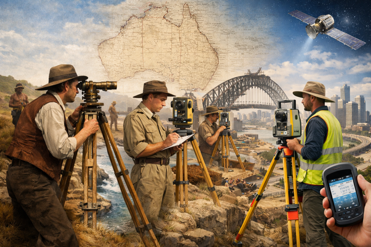
Surveying and mapping have been fundamental to Australian development since European settlement. From the early colonial surveyors who mapped the continent’s coastlines and interior to modern professionals establishing property boundaries and designing infrastructure, accurate spatial data has underpinned everything from land ownership to major construction projects. For over two centuries, these tasks required painstaking manual measurements, theodolites, total stations, and more recently, GPS and satellite technology.
Drone technology is now revolutionising this centuries-old profession with a speed and impact that few anticipated. What once took survey teams days or weeks to accomplish—establishing ground control networks, measuring thousands of points across large sites, creating detailed topographic maps—can now be completed in hours with unprecedented accuracy and detail. A single drone flight can capture millions of data points across hundreds of hectares, creating 3D models so detailed that individual features measuring just centimetres are clearly visible.
The transformation is particularly significant in Australia, where the sheer scale of projects and remoteness of many sites have always made surveying challenging and expensive. Mining operations in the Pilbara, infrastructure projects spanning hundreds of kilometres, agricultural properties larger than some European countries, and urban development across Australia’s sprawling cities all require accurate spatial data. Drones are making this data faster, cheaper, and more comprehensive than ever before.
Australian surveying firms report that drone technology has reduced survey costs by 40-70% for many applications whilst simultaneously improving data quality and detail. Projects that previously required weeks of fieldwork can now be completed in days. Hazardous surveys that put surveyors at risk—cliff faces, unstable slopes, contaminated sites, busy highways—can now be conducted safely from a distance. The economic and safety benefits are driving rapid adoption across the surveying profession.
This article explores how drones are revolutionising surveying and mapping across Australia, from cadastral surveys in suburban Sydney to mine site monitoring in remote Western Australia, from infrastructure corridor mapping to environmental assessments. We’ll examine the technologies that make this possible, the applications delivering results today, and the practical considerations for surveyors and organisations considering drone adoption.
Understanding Photogrammetry: The Technology Behind Drone Surveying
Before exploring specific applications, it’s important to understand the core technology that enables drones to create accurate maps and 3D models: photogrammetry.
Photogrammetry is the science of making measurements from photographs. The basic principle is simple: by taking multiple overlapping photographs of an object or area from different positions, specialised software can calculate the three-dimensional position of every point visible in the images. The mathematics behind this process is complex, but the concept is intuitive—it’s similar to how human depth perception works by comparing the slightly different views from our two eyes.
How Drone Photogrammetry Works
A typical drone surveying workflow involves several steps:
1. Flight planning: The surveyor plans a flight path that ensures complete coverage of the survey area with sufficient overlap between images (typically 70-80% forward overlap and 60-70% side overlap). Modern drone software automates this process—you define the survey area and desired resolution, and the software calculates the optimal flight path, altitude, and camera settings.
2. Ground control: For surveys requiring high absolute accuracy, surveyors establish ground control points (GCPs)—targets placed at precisely known locations measured with GPS or total stations. These GCPs allow the photogrammetry software to georeference the model accurately. For relative accuracy (where you need accurate measurements within the site but don’t need precise geographic coordinates), GCPs may not be necessary.
3. Data capture: The drone flies the planned path autonomously, capturing hundreds or thousands of images. A 100-hectare site might require 800-1,200 images captured during a 25-30 minute flight.
4. Processing: Photogrammetry software (such as Pix4D, Agisoft Metashape, or DroneDeploy) processes the images through several stages:
- Image alignment: The software identifies common features across overlapping images and calculates camera positions
- Dense point cloud generation: Millions of 3D points are calculated representing the surveyed surface
- Mesh generation: The point cloud is converted into a continuous 3D surface
- Texture mapping: The original images are draped over the 3D model to create photorealistic visualisations
- Orthomosaic creation: A geometrically corrected aerial image is created, similar to a map where every pixel represents true ground position
5. Deliverables: The processed data can be exported in various formats: orthomosaic images, digital elevation models (DEMs), 3D models, point clouds, contour maps, and volumetric calculations.
Accuracy Expectations
Drone photogrammetry accuracy depends on several factors: flight altitude, camera quality, ground control, and processing settings. Typical accuracy ranges are:
- Without ground control: 1-3 times the ground sampling distance (GSD). Flying at 100m altitude with a 20-megapixel camera gives approximately 2.5cm GSD, so accuracy would be 2.5-7.5cm.
- With ground control: 1-2 times the GSD, or 1-3cm absolute accuracy for typical survey flights. With careful procedures, sub-centimetre accuracy is achievable.
- Relative accuracy (measurements within the model): Often better than absolute accuracy, with 0.5-1cm achievable for well-executed surveys.
These accuracy levels are sufficient for the vast majority of surveying applications, though traditional surveying methods remain necessary for applications requiring millimetre precision.
1. 3D Mapping and Point Cloud Generation
One of the most powerful capabilities of drone surveying is creating detailed 3D representations of terrain, structures, and entire sites.
Dense Point Clouds
Photogrammetry processing generates point clouds containing millions of individual 3D points, each representing a specific location on the surveyed surface. A 50-hectare site survey might generate 50-200 million points, creating an incredibly detailed 3D representation.
These point clouds can be:
- Visualised in 3D to understand terrain, structures, and spatial relationships
- Measured to determine distances, areas, volumes, and elevations
- Analysed to identify features, detect changes, or assess conditions
- Exported to CAD and design software for engineering and planning
Digital Elevation Models (DEMs)
From point clouds, surveyors create digital elevation models—continuous surfaces representing ground elevation across the survey area. DEMs are fundamental to:
- Engineering design: Road and rail alignments, drainage design, earthwork planning
- Hydrological analysis: Watershed delineation, flood modelling, drainage patterns
- Viewshed analysis: Determining what’s visible from specific locations
- Cut-fill calculations: Comparing existing terrain against design surfaces
A road design project in regional New South Wales used drone-derived DEMs to design a 12-kilometre highway realignment. The detailed elevation data (captured in two days of drone flights) revealed subtle terrain features that influenced the final alignment, avoiding areas of poor drainage and minimising earthwork volumes. The project engineer estimated that the detailed terrain data saved approximately $800,000 in earthwork costs compared to the preliminary design based on less detailed survey data.
3D Mesh Models
Point clouds can be converted into continuous 3D mesh models—surfaces composed of millions of small triangles that represent the surveyed area. When textured with the original photographs, these models create photorealistic 3D representations that can be:
- Viewed in 3D software or web browsers
- Measured for dimensions and areas
- Used for visual communication with stakeholders
- Integrated into virtual reality applications
2. Digital Twins and Site Modelling
Digital twins—virtual replicas of physical assets or sites—are becoming increasingly important for asset management, and drones are the primary technology enabling their creation.
What are Digital Twins?
A digital twin is a detailed digital representation of a physical asset, site, or system that’s updated regularly to reflect current conditions. Unlike static 3D models created once and never updated, digital twins evolve over time, providing a current view of asset conditions.
Applications in Australian Industry
Mining operations: Major mining companies in Western Australia and Queensland use drone-derived digital twins to manage vast open-pit operations. Weekly or monthly drone surveys update the digital twin, showing:
- Current pit configurations and mining progress
- Stockpile volumes and locations
- Haul road conditions
- Infrastructure changes
- Rehabilitation progress
Rio Tinto’s Pilbara iron ore operations use drone surveys to create digital twins of their mine sites, processing the data to track ore movement, optimise haul routes, and plan future mining activities. The digital twins integrate with mine planning software, allowing engineers to design future pit expansions based on current conditions rather than outdated survey data.
Infrastructure management: Asset owners use digital twins to manage complex infrastructure:
- Road networks showing current pavement conditions
- Rail corridors documenting track, signals, and structures
- Utility networks mapping above-ground assets
- Port facilities tracking berth conditions and stockyard inventories
Construction projects: Major construction projects create digital twins that evolve from design through construction to handover:
- Compare as-built conditions against design models
- Track construction progress
- Identify clashes between design and reality
- Create accurate as-built documentation for facility management
Integration with BIM
Building Information Modelling (BIM) is standard practice for major construction projects in Australia. Drone surveys integrate with BIM workflows by:
- Providing accurate existing conditions data for design
- Verifying that construction matches BIM models
- Updating BIM models with as-built information
- Creating reality capture data for facility management
3. Land Surveying and Cadastral Applications
While cadastral surveying (establishing legal property boundaries) remains the domain of licensed surveyors using traditional methods, drones are increasingly supporting surveying workflows.
Topographic Surveys
Drones excel at topographic surveys—mapping the natural and man-made features of land. Applications include:
Subdivision planning: Developers use drone surveys to understand site topography before designing subdivisions, identifying optimal lot layouts, road alignments, and drainage solutions.
Property development: Detailed topographic data informs building design, ensuring structures are positioned optimally relative to terrain, views, and drainage.
Rural property mapping: Large rural properties use drone surveys to map terrain, water features, vegetation, and infrastructure across areas too large for economical traditional surveying.
Boundary Surveys Support
While drones cannot replace licensed surveyors for establishing legal boundaries, they support boundary survey workflows:
- Providing aerial context showing fence lines, occupation, and improvements
- Identifying potential boundary issues before detailed surveys
- Creating visual records of boundary conditions
- Supporting expert evidence in boundary disputes
Accuracy Considerations
For cadastral purposes, surveys must meet strict accuracy standards defined by state and territory surveying regulations. Traditional surveying methods (total stations, GPS) remain necessary for establishing legal boundaries, but drones provide valuable supporting data and context.
4. Infrastructure Assessment and Monitoring
Australia’s vast infrastructure networks—roads, rail, pipelines, power lines, water systems—require regular inspection and monitoring. Drones are transforming how this infrastructure is assessed.
Linear Infrastructure Mapping
Drones are particularly effective for mapping linear infrastructure:
Road corridors: State road authorities use drones to:
- Assess pavement conditions across entire road networks
- Document road geometry and cross-sections
- Identify maintenance needs
- Plan rehabilitation projects
- Monitor construction progress on road projects
Rail corridors: Rail operators use drones to inspect:
- Track alignment and geometry
- Ballast conditions
- Vegetation encroachment
- Structure conditions (bridges, culverts, signals)
- Corridor security and encroachments
Pipelines and utilities: Utility operators survey corridors to:
- Identify encroachments and unauthorised activities
- Monitor vegetation management
- Assess access track conditions
- Document asset conditions
A gas pipeline operator in Queensland uses quarterly drone surveys along 400 kilometres of pipeline corridor. The surveys identify vegetation encroachment, unauthorised construction near the pipeline, and access track deterioration. Issues identified in drone imagery are prioritised for ground inspection and remediation. The operator reports that drone monitoring has reduced corridor inspection costs by 60% whilst improving detection of potential issues.
Bridge and Structure Inspection
Drones access areas of bridges and structures that are difficult or dangerous for inspectors:
- Underside of bridge decks
- Pier conditions in waterways
- High structural elements
- Confined spaces
High-resolution imagery reveals cracks, spalling, corrosion, and other defects that inform maintenance planning. While drones don’t replace detailed hands-on inspections, they provide valuable preliminary assessments and focus detailed inspections on areas of concern.
Change Detection
Regular drone surveys enable change detection—identifying how infrastructure conditions change over time:
- Pavement deterioration rates
- Vegetation growth
- Erosion and scour around structures
- Settlement or movement
- Unauthorised modifications or encroachments
5. Volumetric Calculations and Earthwork Measurement
Accurate volume measurement is critical for many industries, and drones have revolutionised this application.
Stockpile Measurement
Industries that manage stockpiles—mining, quarrying, construction, agriculture—use drones for inventory management:
Mining stockpiles: Mines maintain stockpiles of ore, waste rock, and various materials. Accurate volume measurement is essential for:
- Inventory reconciliation
- Production reporting
- Financial reporting (stockpiles represent significant asset value)
- Logistics planning
Traditional stockpile measurement methods (manual measurement, GPS surveys) are time-consuming and often inaccurate. Drones measure stockpiles in minutes with 1-3% accuracy.
A coal mine in the Hunter Valley of New South Wales uses weekly drone surveys to measure coal stockpiles across their site. The surveys, which take 30 minutes to fly and 2 hours to process, replaced manual measurements that took 2 days and were significantly less accurate. The improved accuracy has eliminated inventory discrepancies that previously caused reconciliation problems and financial reporting issues.
Quarry operations: Quarries use drone surveys to:
- Measure product stockpiles for sales and inventory
- Track waste material volumes
- Monitor pit progression
- Calculate extraction volumes
Construction materials: Builders and contractors measure stockpiles of:
- Aggregates and sand
- Topsoil and fill materials
- Recycled materials
- Waste for disposal
Cut-Fill Analysis
Earthwork projects require accurate measurement of material cut (excavated) and fill (placed). Drones enable:
Pre-construction surveys: Establish baseline terrain conditions before work begins
Regular progress surveys: Measure earthwork progress and verify contractor quantities
Final surveys: Document completed earthwork and calculate final quantities
Comparison against design: Verify that earthwork matches design specifications
The accuracy and speed of drone surveys make them ideal for earthwork measurement. A road construction project can be surveyed weekly to track progress, with cut-fill calculations completed within hours of each flight.
Landfill and Waste Management
Landfill operators use drones to:
- Measure remaining airspace capacity
- Track waste placement and compaction
- Monitor environmental controls
- Plan future cell development
- Report to regulators
Regular drone surveys provide accurate capacity data that informs operational decisions and regulatory reporting.
6. Environmental Mapping and Land Cover Analysis
Environmental assessment and monitoring increasingly rely on drone technology for detailed, repeatable data collection.
Vegetation Mapping
Drones equipped with RGB and multispectral cameras map vegetation:
Species identification: High-resolution imagery combined with multispectral data helps identify vegetation species and communities
Vegetation health assessment: Multispectral indices (NDVI, etc.) reveal vegetation health and stress
Canopy cover analysis: Measure tree canopy coverage for environmental assessments
Weed mapping: Identify invasive species for targeted management
Revegetation monitoring: Track success of rehabilitation and revegetation projects
Coastal and Marine Environments
Drones survey coastal environments for:
- Beach erosion monitoring
- Dune vegetation mapping
- Coastal infrastructure assessment
- Marine habitat mapping (in clear shallow water)
- Coastal development planning
Wetland and Waterway Assessment
Environmental consultants use drones to map:
- Wetland extent and conditions
- Riparian vegetation
- Stream bank erosion
- Water quality indicators (turbidity, algae)
- Flood extent and impacts
Mining Rehabilitation
Mining companies must rehabilitate disturbed land, and drones monitor rehabilitation progress:
- Measure rehabilitated areas
- Assess vegetation establishment
- Monitor erosion and drainage
- Document compliance with rehabilitation plans
- Provide evidence for regulatory reporting
7. Urban Planning and Development Mapping
Urban planners and developers use drone surveys to inform planning decisions and communicate proposals.
Site Analysis
Before designing developments, planners use drone surveys to:
- Understand existing site conditions
- Identify constraints (slopes, vegetation, drainage)
- Assess surrounding context
- Analyse access and connectivity
- Evaluate views and solar access
Development Visualisation
Drone-derived 3D models support development visualisation:
- Create accurate base models for architectural visualisations
- Show proposed developments in context
- Assess visual impacts from various viewpoints
- Support community consultation
Urban Growth Monitoring
Local governments use drone surveys to:
- Monitor urban expansion
- Track development activity
- Assess infrastructure needs
- Update planning schemes
- Document heritage areas
Smart City Applications
Progressive councils integrate drone data into smart city initiatives:
- Asset management systems
- Infrastructure planning
- Emergency management
- Community engagement
- Environmental monitoring
LiDAR vs Photogrammetry: Choosing the Right Technology
While photogrammetry is the most common drone surveying method, LiDAR (Light Detection and Ranging) offers advantages for specific applications.
How LiDAR Works
LiDAR uses laser pulses to measure distances. A LiDAR sensor emits thousands of laser pulses per second and measures the time for each pulse to return, calculating precise distances to create detailed 3D point clouds.
LiDAR Advantages
Vegetation penetration: LiDAR can penetrate vegetation canopy to measure ground surface beneath—critical for surveying forested areas where photogrammetry only captures the tree canopy.
Consistent accuracy: LiDAR accuracy is less dependent on lighting conditions and surface texture than photogrammetry.
Detailed vertical structures: LiDAR excels at capturing vertical features like building facades, power lines, and complex structures.
Photogrammetry Advantages
Lower cost: Photogrammetry equipment costs $5,000-25,000 compared to $80,000-200,000+ for LiDAR systems.
Colour information: Photogrammetry produces photorealistic models with true colour, whilst LiDAR captures only geometry.
Simpler processing: Photogrammetry software is more accessible and user-friendly than LiDAR processing tools.
Sufficient for most applications: For open terrain and most surveying applications, photogrammetry provides adequate accuracy at much lower cost.
When to Choose LiDAR
LiDAR is worth the additional cost for:
- Surveying heavily vegetated areas where ground surface must be measured
- Power line corridor surveys requiring precise wire position data
- Complex urban environments with many vertical structures
- Applications requiring highest possible accuracy
- Projects where vegetation penetration is critical
Most Australian surveying firms use photogrammetry for the majority of projects, reserving LiDAR for specific applications where its advantages justify the cost.
Integration with GIS and Mapping Software
Drone survey data integrates seamlessly with Geographic Information Systems (GIS) and mapping software used across industries.
GIS Integration
Drone-derived data exports to standard GIS formats:
- Orthomosaics: Import as georeferenced raster layers in ArcGIS, QGIS, MapInfo
- Point clouds: Import into GIS for analysis and visualisation
- Vector data: Extract features (buildings, roads, vegetation) as vector layers
- DEMs: Use for terrain analysis, hydrological modelling, viewshed analysis
CAD and Design Software
Engineering and design software accepts drone data:
- AutoCAD Civil 3D: Import point clouds and surfaces for design
- 12d Model: Australian surveying and engineering software integrates drone data
- Bentley MicroStation: Use drone data for infrastructure design
- Trimble Business Center: Process and integrate drone surveys with traditional survey data
Cloud-Based Platforms
Modern drone surveying increasingly uses cloud-based platforms:
- DroneDeploy: Cloud processing and analysis with GIS integration
- Propeller: Designed for construction and mining with volume calculations
- Pix4D Cloud: Cloud processing with various output formats
- Site Scan: Trimble’s platform integrating drone data with construction workflows
Cloud platforms enable:
- Processing without powerful local computers
- Sharing data with stakeholders via web browsers
- Automated analysis and reporting
- Integration with other business systems
The Economics of Drone Surveying
Understanding the cost-benefit equation helps organisations decide whether to invest in drone surveying capability.
Cost Comparison: Drones vs Traditional Methods
Traditional topographic survey of 50-hectare site:
- Survey crew: 5-7 days @ $2,500/day = $12,500-17,500
- Total cost: $12,500-17,500
- Deliverables: Spot heights, contours, feature survey
Drone survey of same site:
- Flight time: 45 minutes
- Processing time: 4-6 hours
- Total cost: $3,000-5,000 (if contracted) or $500-1,000 (if in-house)
- Deliverables: Orthomosaic, point cloud, DEM, contours, 3D model, volumes
Savings: 60-80% cost reduction with significantly more comprehensive data.
In-House vs Contracted Services
In-house capability investment:
- Drone and sensors: $8,000-80,000
- Processing software: $1,500-10,000 annually
- Training: $2,000-10,000
- Insurance: $1,500-3,000 annually
- Total first year: $15,000-100,000
When in-house makes sense:
- Regular surveying needs (monthly or more frequent)
- Multiple projects requiring surveys
- Desire for immediate data access
- Staff interested in developing drone skills
When to contract services:
- Occasional surveying needs
- Specialised requirements (LiDAR, complex processing)
- No internal capacity for drone operations
- Preference to avoid equipment ownership
Many organisations start with contracted services to prove value, then transition to in-house capability once benefits are established.
The Future of Drone Surveying in Australia
Drone surveying technology continues to evolve rapidly, with several trends shaping the future:
Increased automation: Drones are becoming more autonomous, with some systems conducting scheduled surveys without human intervention—particularly valuable for remote mine sites or infrastructure monitoring.
AI-powered analysis: Machine learning algorithms automatically extract features, identify changes, and detect anomalies from drone data, reducing manual processing time.
Real-time processing: Processing capabilities are moving to the edge, with some systems processing data during flight or immediately after, providing results within minutes rather than hours.
Integration with other technologies: Drone data increasingly integrates with IoT sensors, satellite imagery, and other data sources to provide comprehensive site intelligence.
Regulatory evolution: CASA continues refining regulations to enable more advanced operations whilst maintaining safety, potentially enabling routine BVLOS operations for surveying applications.
For Australian surveyors and organisations requiring spatial data, drone technology represents not just an incremental improvement but a fundamental transformation in how surveying is conducted. The combination of reduced costs, improved safety, enhanced data quality, and faster turnaround times creates compelling value that’s driving rapid adoption across industries.
Frequently Asked Questions
Q: How accurate are drone surveys compared to traditional surveying methods?
A: Drone photogrammetry typically achieves 1-3cm accuracy with proper ground control points, which is sufficient for most surveying applications including topographic surveys, volume calculations, and construction monitoring. Traditional surveying with total stations or RTK GPS achieves sub-centimetre (2-5mm) accuracy and remains necessary for cadastral surveys, precise setting out, and applications requiring highest precision. For the vast majority of surveying needs—topographic mapping, earthwork measurement, asset documentation—drone accuracy is more than adequate and the speed and cost advantages are substantial. LiDAR-equipped drones can achieve even higher accuracy, approaching traditional surveying precision.
Q: Do I need ground control points for accurate drone surveys?
A: It depends on your accuracy requirements. For relative accuracy (accurate measurements within the survey area but not necessarily precise geographic coordinates), modern drones with RTK or PPK GPS can achieve good results without ground control points. For absolute accuracy (precise geographic positioning), ground control points significantly improve accuracy, typically from 5-10cm without GCPs to 1-3cm with GCPs. Best practice for professional surveys is to use at least 3-5 ground control points even with RTK drones, with additional points for larger areas or higher accuracy requirements. The time to establish GCPs (typically 30-60 minutes for a standard survey) is minimal compared to the accuracy improvement they provide.
Q: What’s the difference between photogrammetry and LiDAR for drone surveying?
A: Photogrammetry uses overlapping photographs to create 3D models and is the most common drone surveying method. It’s cost-effective (equipment costs $5,000-25,000), produces photorealistic models with true colour, and provides sufficient accuracy for most applications. LiDAR uses laser pulses to measure distances and excels at penetrating vegetation to measure ground surface, capturing vertical structures precisely, and providing consistent accuracy regardless of lighting. However, LiDAR equipment costs $80,000-200,000+ and doesn’t capture colour information. For most Australian surveying applications—open terrain, construction sites, mining operations—photogrammetry is the better choice. LiDAR is worth the investment for heavily vegetated areas, power line surveys, or applications requiring vegetation penetration.
Q: How large an area can a drone survey in a single flight?
A: Coverage depends on drone type, flight altitude, and required resolution. A typical multirotor drone (DJI Phantom 4 RTK, Mavic 3 Enterprise) can survey 50-100 hectares per battery at 100m altitude, with flight times of 25-35 minutes. Fixed-wing drones (senseFly eBee, WingtraOne) can survey 200-400 hectares per flight at higher altitudes. For very large areas (1,000+ hectares), multiple flights are required, but the drone can be landed, battery changed, and next flight started within minutes. A 500-hectare mine site might require 3-4 flights totalling 2-3 hours including battery changes, compared to weeks of traditional surveying.
Q: What weather conditions prevent drone surveying operations?
A: Drones cannot operate safely in rain, high winds (typically above 10-15 m/s for multirotors, 15-20 m/s for fixed-wing), very low visibility (fog, heavy dust), or extreme temperatures. For surveying specifically, additional considerations include: cloud cover (creates shadows that affect photogrammetry quality), very bright conditions (can cause overexposed images), and recent rain (wet surfaces reflect light differently, affecting results). In Australian conditions, wind is often the limiting factor, particularly in exposed locations. Most surveyors find they can complete 80-90% of planned surveys by maintaining flexible scheduling. For critical surveys, plan a 2-3 day window to accommodate weather variability.
Q: Can drone surveys be used for legal boundary surveys?
A: No, drone surveys cannot establish legal property boundaries in Australia. Cadastral surveying (boundary surveys) must be conducted by licensed surveyors using approved methods (total stations, GPS) that meet strict accuracy standards defined by state and territory surveying regulations. However, drones provide valuable supporting information for boundary surveys: aerial context showing fence lines and occupation, identification of potential boundary issues before detailed surveys, visual records of boundary conditions, and supporting evidence for boundary disputes. Drones complement but don’t replace traditional cadastral surveying methods.
Q: How do I choose between conducting drone surveys in-house or contracting services?
A: Consider in-house capability if you have regular surveying needs (monthly or more frequent), multiple projects requiring surveys, desire for immediate data access without scheduling delays, and staff interested in developing drone skills. Initial investment is $15,000-40,000 for equipment, software, training, and insurance. Contract services if you have occasional surveying needs, require specialised capabilities (LiDAR, complex analysis), lack internal capacity for drone operations, or prefer to avoid equipment ownership. Many organisations start with contracted services to prove value, then transition to in-house capability once benefits are established. Some maintain hybrid approaches—owning basic equipment for routine surveys whilst contracting specialists for complex projects.
Q: What software do I need to process drone survey data?
A: Photogrammetry processing requires specialised software such as Pix4D Mapper ($350/month or $4,990 perpetual licence), Agisoft Metashape ($179-$3,499 depending on version), DroneDeploy ($3,000-10,000/year), or Propeller ($3,000-8,000/year for construction/mining focus). These platforms process images into orthomosaics, point clouds, DEMs, and 3D models. You’ll also need CAD or GIS software to use the processed data: AutoCAD Civil 3D, 12d Model, ArcGIS, QGIS (free), or similar. Processing requires reasonably powerful computers: minimum 16GB RAM (32GB+ recommended), dedicated graphics card, and fast storage (SSD). Cloud-based platforms (DroneDeploy, Propeller, Pix4D Cloud) eliminate local processing requirements but involve ongoing subscription costs.
Q: How long does it take to process drone survey data?
A: Processing time depends on survey size, computer power, and desired outputs. A typical 50-hectare survey with 500-800 images takes 2-4 hours to process on a modern computer (Intel i7/i9 or AMD Ryzen 7/9, 32GB RAM, dedicated GPU). Larger surveys or slower computers take longer—a 200-hectare survey might take 6-12 hours. Cloud processing platforms often process faster by using powerful server infrastructure. Most processing runs unattended, so you can start processing at the end of the day and have results the next morning. Additional time is required for quality checking, extracting specific deliverables, and creating reports—budget 1-2 hours for finalising outputs.
Q: What deliverables can I expect from a drone survey?
A: Standard drone survey deliverables include: orthomosaic (geometrically corrected aerial image, typically GeoTIFF format), point cloud (millions of 3D points, LAS or LAZ format), digital elevation model/digital surface model (DEM/DSM showing terrain elevations), 3D mesh model (textured 3D surface), contour maps (at specified intervals), volume calculations (cut-fill, stockpiles), and cross-sections (terrain profiles). Additional deliverables might include: CAD drawings, GIS shapefiles, PDF reports, web-based viewers for sharing with stakeholders, and time-series comparisons showing changes. Specify required deliverables when engaging drone service providers to ensure you receive data in formats compatible with your workflows.
Q: How do drone surveys integrate with BIM (Building Information Modelling)?
A: Drone surveys integrate with BIM workflows at several stages: providing accurate existing conditions data for design (point clouds import into Revit, Navisworks, or other BIM software), verifying that construction matches BIM models (compare as-built drone data against design models to identify discrepancies), updating BIM models with as-built information (use drone data to update models with actual constructed conditions), and creating reality capture for facility management (provide accurate geometric data for facility management BIM). Most BIM software accepts standard point cloud formats (E57, RCS, RCP) that drone processing software can export. The integration enables clash detection, progress verification, and accurate as-built documentation.
Q: What are the main cost components of drone surveying?
A: For in-house operations, costs include: equipment ($8,000-25,000 for drone and sensors, more for LiDAR), processing software ($1,500-6,000 annually), training and licensing ($2,000-5,000 for RePL and survey-specific training), insurance ($1,500-3,000 annually), batteries and spare parts ($1,000-2,000 annually), and staff time (flight planning, data capture, processing, deliverable preparation). For contracted services, expect $2,000-8,000 per survey depending on size, complexity, and deliverables. Ground control establishment adds $500-2,000 depending on site size and access. Despite these costs, drone surveys typically cost 40-70% less than traditional surveying for equivalent coverage whilst providing more comprehensive data.
Q: Can drones survey in areas with vegetation or tree cover?
A: Photogrammetry-based drone surveys capture the top surface visible to the camera, which in vegetated areas means the tree canopy rather than ground surface. For surveying ground beneath vegetation, you need LiDAR-equipped drones that can penetrate canopy gaps to measure ground surface. LiDAR typically achieves 30-70% ground point density in moderate vegetation, sufficient for creating ground models. For dense vegetation with complete canopy closure, even LiDAR struggles to reach ground. In these situations, traditional surveying methods or vegetation clearing may be necessary. For partially vegetated areas, combining drone surveys (for open areas) with traditional surveying (for vegetated areas) often provides the most cost-effective solution.
Q: How often should infrastructure be surveyed with drones?
A: Survey frequency depends on infrastructure type and monitoring objectives. Linear infrastructure (roads, rail, pipelines) benefits from annual or bi-annual surveys to track condition changes and plan maintenance. Active construction sites typically require weekly or fortnightly surveys to monitor progress and verify quantities. Mining operations often conduct monthly surveys for production reporting and planning. Stockpiles might be surveyed weekly or monthly for inventory management. Critical infrastructure or areas of concern might warrant quarterly surveys. Environmental monitoring frequency depends on regulatory requirements and seasonal factors. Establish baseline survey frequency but remain flexible to increase frequency when issues are identified or critical activities are underway.
Q: What accuracy is required for different surveying applications?
A: Accuracy requirements vary by application: cadastral/boundary surveys require sub-centimetre accuracy (traditional surveying methods necessary), topographic surveys typically require 2-5cm accuracy (achievable with drone photogrammetry with GCPs), construction progress monitoring requires 3-5cm accuracy (drone surveys adequate), earthwork volume calculations require 2-5cm accuracy for payment purposes (drone surveys with GCPs appropriate), stockpile measurements can tolerate 5-10cm accuracy (drone surveys without GCPs often sufficient), environmental mapping and vegetation assessment can work with 10-20cm accuracy (basic drone surveys adequate), and infrastructure condition assessment focuses on feature identification rather than absolute accuracy (high-resolution imagery more important than precision). Match your survey method and procedures to the accuracy requirements of your specific application.
Q: Do I need CASA approval for every drone survey?
A: You don’t need CASA approval for each individual survey, but you must operate within CASA regulations. If operating under excluded RPA category (drone under 2kg, meeting all standard conditions), you just need drone registration and compliance with standard rules—no per-flight approvals required. If operating under a ReOC, your certificate authorises operations within specified parameters—you don’t need approval for each flight that fits within your authorisations. However, certain operations require specific approvals regardless of your credentials: operations in controlled airspace (near airports), operations in restricted areas, night operations, and BVLOS operations all require prior approval. For routine surveying in unrestricted airspace during daylight, no per-flight approvals are needed if you’re properly licensed and accredited.
Q: How do I ensure my drone survey data is accurate and reliable?
A: Ensure accuracy through proper procedures: establish ground control points measured with GPS or total station (minimum 3-5 points, more for larger areas), fly at appropriate altitude for required resolution (lower altitude = higher resolution but longer flight time), maintain sufficient image overlap (70-80% forward, 60-70% side), fly in good conditions (avoid high winds, harsh lighting, recent rain), use quality processing software with appropriate settings, include check points (additional surveyed points not used in processing) to verify accuracy, compare results against known measurements or previous surveys, and follow consistent procedures for repeatable results. For critical surveys, consider having results verified by licensed surveyors or conducting validation surveys of key areas.
