Advanced Aerial Intelligence for Enterprise Operations
Transform your inspection, survey and monitoring workflows with precision drone technology and AI-powered analytics. 30+ years of expertise, 15+ years of UAV operations.
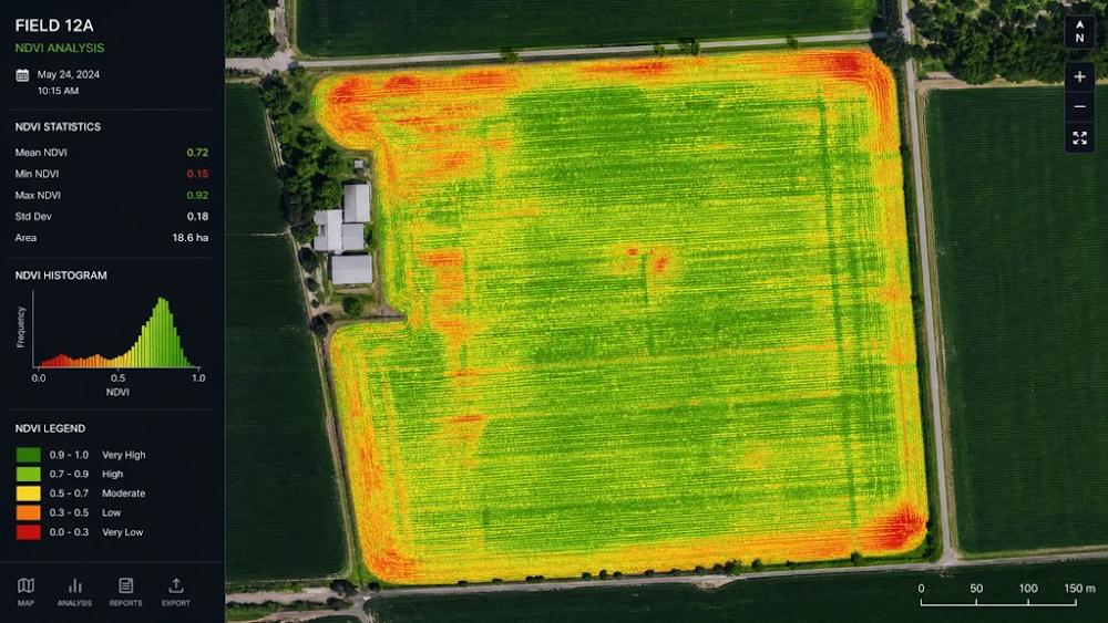
Multispectral & LiDAR: 5-band systems and laser scanning for vegetation analysis
Data Processing
Photogrammetry: Structure-from-Motion algorithms for 3D reconstruction
Cloud Processing: Automated workflows with quality control and accuracy verification
Delivery Platform: Real-time stakeholder access and collaborative review
Positioning & Accuracy
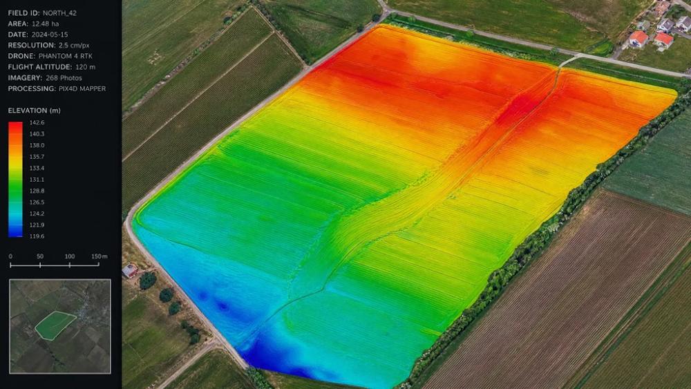
RTK/PPK GPS: Centimeter-level accuracy without ground control points
Ground Control Points: Survey-grade targets for enhanced accuracy
Sub-Centimeter Precision: Engineering-grade accuracy in final deliverables
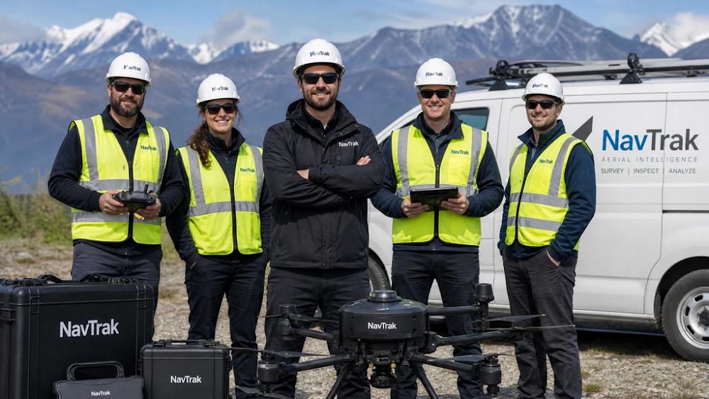
About NavTrak
NavTrak Advanced Aerial Intelligence Systems operates at the intersection of precision agriculture technology and advanced unmanned aerial systems, delivering enterprise-grade geospatial intelligence and remote sensing solutions.
Company Overview
Established in 1992, NavTrak began as a specialist in precision farming methodologies. In 2009, recognising the transformative potential of unmanned aerial systems, we integrated UAV technology into our service portfolio. Today, we operate as a full-spectrum aerial intelligence provider with 30+ years of precision agriculture expertise and 15+ years of specialised UAV operations.
Professional Credentials
✓CASA certified UAV operations and airspace compliance
✓Comprehensive insurance coverage for all operations
✓Compliant processes and quality management systems
Environmental Commitment
NavTrak’s precision-based approach delivers measurable environmental benefits: targeted intervention protocols reducing chemical application by 70%, ecosystem monitoring supporting conservation programs, and sustainable infrastructure development through accurate environmental baseline documentation.
Frequently Asked Questions
Find answers to common questions about our drone services, regulatory compliance and safety protocols.
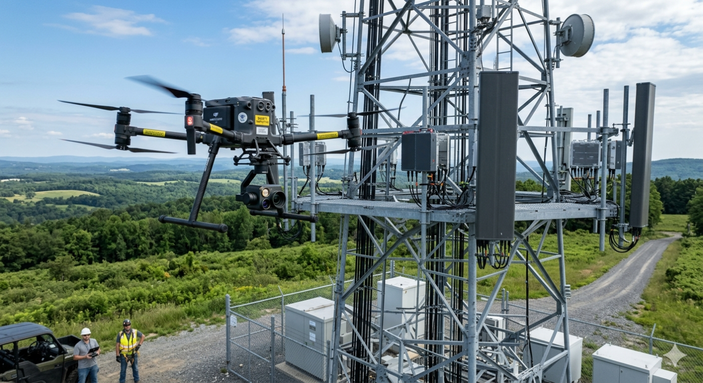
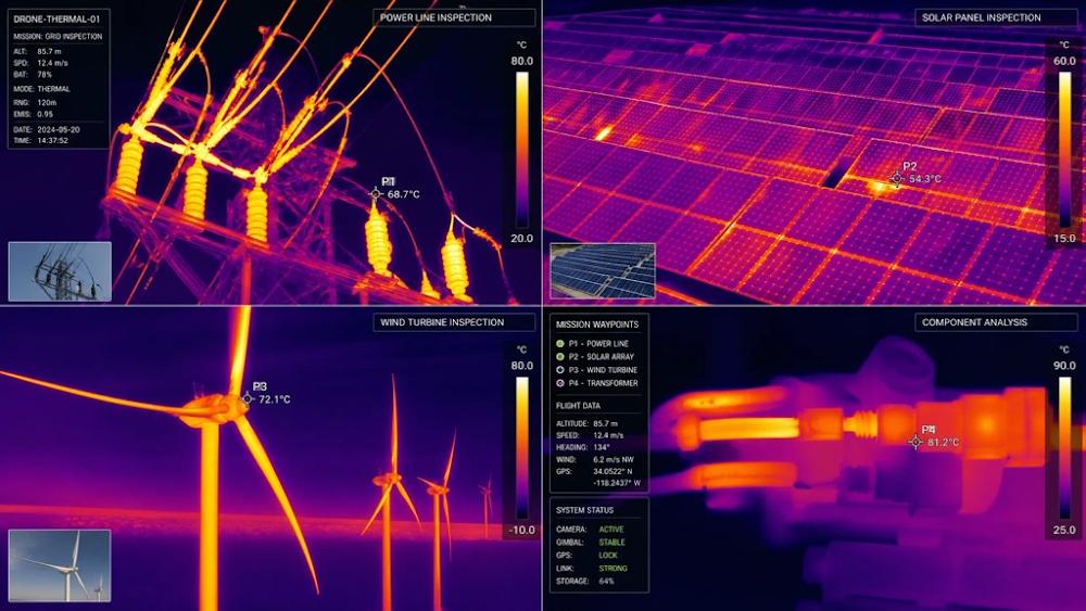
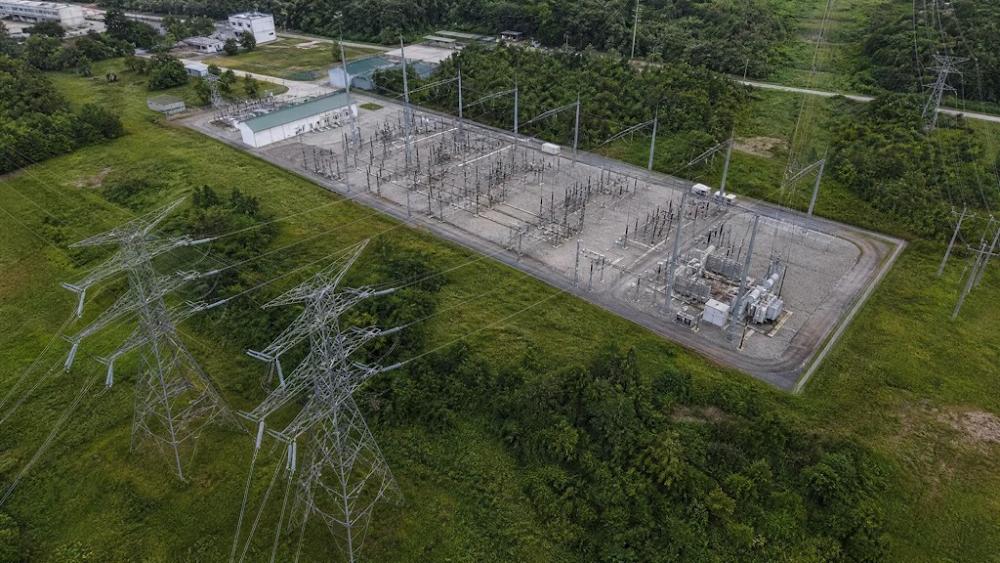
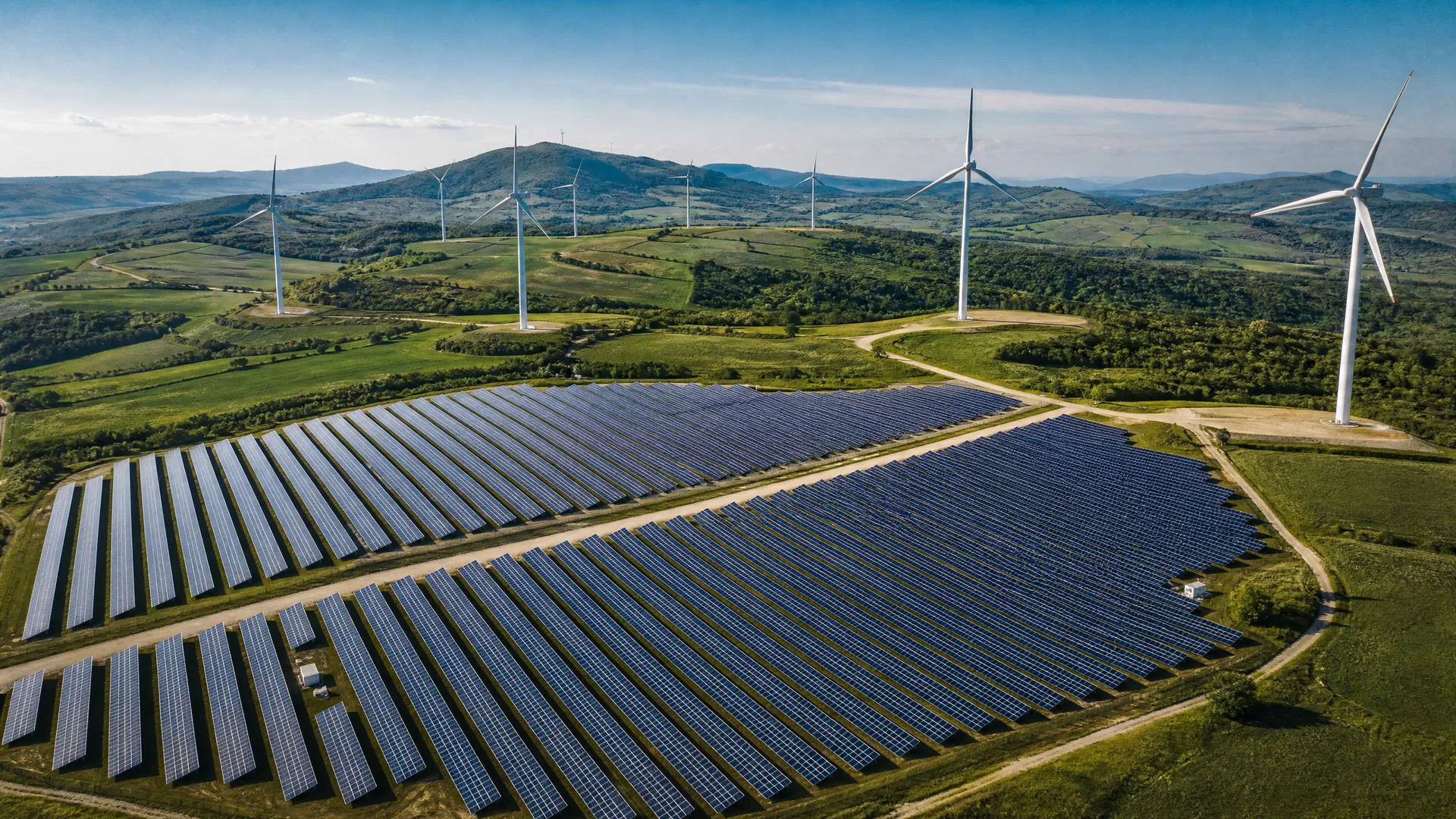
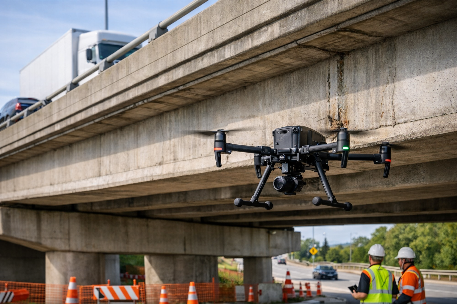
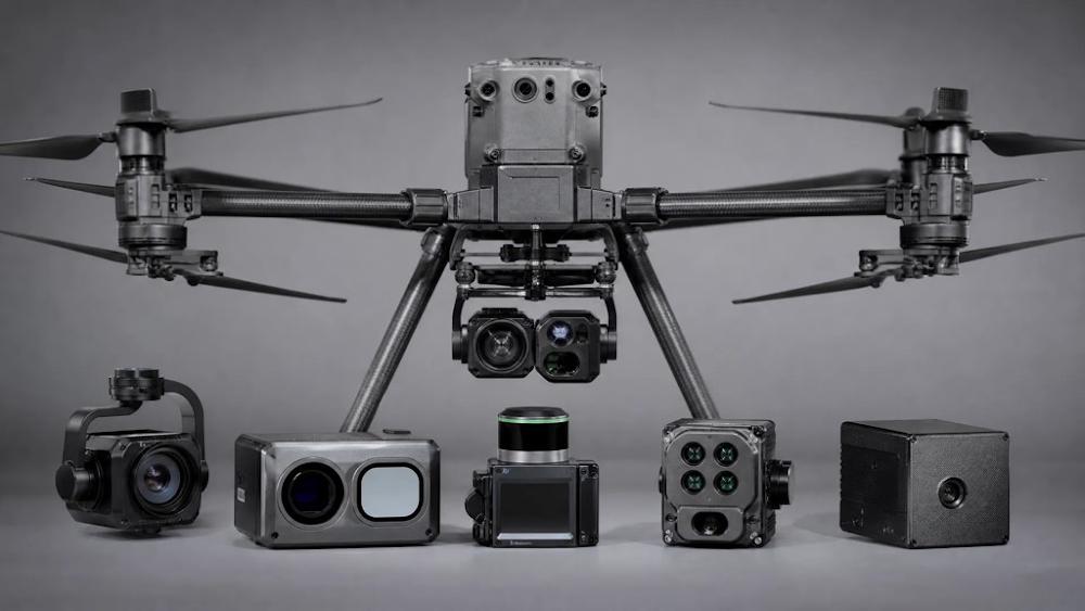
NavTrak provides comprehensive aerial intelligence services including mapping and surveying, inspection services (infrastructure, utilities, renewable energy) and agricultural intelligence. Our services utilise advanced UAV technology with RGB, thermal, multispectral and LiDAR sensors to deliver precise data and actionable insights for enterprise operations.
Our drones achieve centimetre-level accuracy for mapping and surveying applications using advanced GPS/RTK and PPK positioning and high-resolution sensors. For thermal and multispectral analysis, we provide georeferenced data with precision suitable for professional decision-making. Accuracy depends on the specific application and sensor type used.
Most projects are completed within 5-10 business days from data collection to final deliverables. Simple mapping projects can be delivered on the same day, while complex analysis projects may take 2-3 weeks. We provide custom timelines based on project scope, data volume, and analysis requirements.
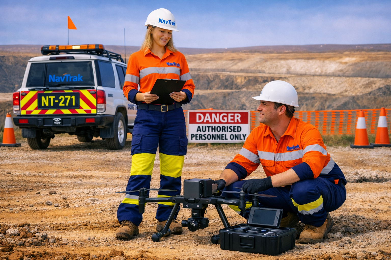
Yes, NavTrak holds full CASA (Civil Aviation Safety Authority) certification for commercial drone operations throughout Australia. Our pilots are licensed Remote Pilot License (RePL) holders with current medical clearances. We maintain comprehensive insurance coverage and comply with all CASA regulations and airspace restrictions.
NavTrak maintains comprehensive professional indemnity and public liability insurance specifically covering commercial drone operations. Our insurance covers third-party liability, equipment damage, and data protection. We can provide certificates of currency and detailed coverage information upon request.
Drone operations are subject to CASA regulations including altitude limits (typically 120 meters AGL), proximity to airports, and populated areas. NavTrak conducts thorough airspace analysis for every project and obtains necessary approvals. We can operate in controlled airspace with appropriate NOTAM (Notice to Airmen) and coordination with relevant authorities.
Data privacy and security are paramount. We comply with Australian Privacy Principles and can sign NDAs for sensitive projects. Data is stored securely and deleted according to agreed schedules. Clients retain full ownership and control of their data.
NavTrak follows strict safety protocols including pre-flight inspections, weather assessment, airspace clearance verification and continuous monitoring during flights. Our pilots maintain safe distances from people and property, use spotters when required and have emergency procedures in place. We conduct safety briefings for all stakeholders on site.
All NavTrak drones feature redundant safety systems including automatic return-to-home, failsafe mechanisms and real-time monitoring. In case of malfunction, drones automatically land safely or return to the launch point. Our pilots are trained in emergency procedures and maintain situational awareness throughout operations.
Yes, all NavTrak pilots undergo comprehensive emergency response training including first aid certification, emergency landing procedures and incident management. We maintain detailed safety records and conduct regular training updates to ensure compliance with CASA requirements and industry best practices.
Our drones are weather-resistant but operate within strict safety parameters. We do not fly in rain, high winds (typically above 25 knots), or severe weather. Weather assessment is conducted before every flight, and operations are postponed if conditions are unsafe. We can reschedule projects to optimal weather windows.
Get in Touch
Complete the form below and we’ll contact you to discuss your project requirements.